|
|
By Dan Gunderson, Minnesota Public Radio
June 25, 2001
|
|
RealAudio |
An Arkansas researcher is delving deep to uncover new information about how American Indians lived on the Great Plains hundreds of years ago, without turning a shovelful of dirt.
| |
|
|
|
||
TO THE UNTRAINED EYE, there's no indication what lies beneath this grassy windswept bluff overlooking the Missouri River, a few miles north of Bismarck. But 300 or 400 years ago, this site was a bustling Mandan Indian village of about 2,000. It's known as Double Ditch village because of the ditches dug around the village for protection from invaders.
"North Dakota was wise enough to preserve all these sites. These are real treasure houses for archeology. Giant villages, undisturbed, they haven't been plowed, they haven't been built on," says University of Arkansas professor Ken Kvamme, who has focused on plains archeology for 25 years. For about the last five years he's changed tools, from shovels to delicate electronic devices and computers.
Kvamme uses three primary pieces of equipment. A magnetometer, essentially a high-powered metal detector, can detect fire pits, because the carbon-laden soil is highly magnetic. Another device uses probes to measure tiny changes in the electrical conductivity of soil, pinpointing hard packed floors of homes and other anomalies. Ground penetrating radar is the third piece of the picture. A computer combines all the digital information, to produce an image of what's under the ground.
"This is the native village," Kvamme points out. "You can see the house rings. Some of these blobs around it are storage bins for corn."
Past excavation of these sites using more traditional dig-and-sift techniques centered on the inside of houses, and found little evidence of food storage. Using remote sensing, Ken Kvamme found dozens of grain storage pits outside of homes. Its a new clue as to how these people lived, keeping large amounts of corn, perhaps for trade with nomadic tribes. Kvamme says the technology won't replace traditional archaeological work, but it's like giving an archaeologist X-ray vision.
| |
|
|
|
||
Kvamme mapped another site about 40 miles up the Missouri River Fort Clark, named after William Clark of the famous expedition, was one of the earliest fur-trading posts in the Dakotas.
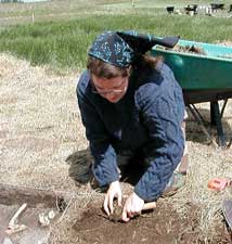
Students from the University of Missouri are spending six weeks at Fort Clark excavating areas of the site selected using Ken Kvamme's maps.
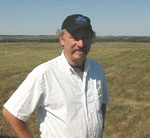
"It's just an incredible aid, because we can plan our work," says anthropologist Raymond Wood, who is helping direct the dig. "This kind of work is time consuming and expensive. We can budget our time nicely using these images."
Raymond Wood is an expert on sites like this one. He knows a great deal about life here in the 1700s, based on journal entries. But what is not well known is how the trading post was built, nor its exact size. The remote sensing maps of the site clearly show foundations of the fort and other buildings. Using the map, the students have begun excavating a portion of the buried wall.
Raymond Wood says he expects remote-sensing technology to become an essential tool for archeology as researchers begin to realize its benefits.
Ken Kvamme says the technology is not useful only for scientists. A Wisconsin tribe recently purchased its own equipment to help find and protect ancient burial sites without having to excavate the culturally sensitive areas.
Kvamme is one of a handful of U.S. researchers now using remote sensing technology, but he says it's routinely used in Europe, and he expects widespread acceptance here in the next decade.
FOR MORE INFORMATION
Radio Listening : News & Features : Events Calendar : Your Voice : About Us